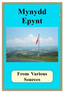
Abandoned Communities Mynydd Epynt

Abandoned Communities Mynydd Epynt
432 Downloads

I WILL NOW TURN TO THE PROCESS OF EVICTION. I want to deal with the way in which the intentions of the War Office were communicated to the local people, the emotional and practical responses of the people, and the way in which protests against the eviction were expressed.The first indication that Mynydd Epynt would be taken over was provided in an informal manner. On a Monday in mid September 1939 a khaki coloured Hillman Minx visited several farms and the primary school. It was driven by someone described by a male onlooker as a very attractive blond ATS girl, and she was accompanied by an army captain. The captain’s task was to explain that the War Office were thinking of taking over the area and he was required to carry out a survey. See Ronald Davies, Epynt Without People, Talybont, c 1971.Memories recorded by Epynt residents suggest that from the beginning the War Office intended to take an authoritarian approach to the process of eviction. Edna Williams was present when the captain visited her home. Her father asked him “What if we cannot find somewhere else to go?”, to which the reply was “Then you will be thrown out on the road”. There was no attempt to consult the local people on the general principle of eviction or on any aspect of the way in which it would be put into practice.Left:The site of Cilieni School School in 1940

At Cilieni School the captain spoke to the teacher, Mrs Olwen Davies, apparently in front of the pupils. They would not, however, have understood much of what he said as he spoke in English. Mrs Davies was immediately distressed and alarmed, but found herself unable to pass on to the children the information she had received. She endeavoured to complete the last one or two lessons of the day as normally as possible,

The Highways and Byways of Surrey

The Highways and Byways of Surrey
433 Downloads

PREFACE

A PREFACE OUGHT NOT TO CONTAIN AN APOLOGY. But mine must contain at least an explanation, if only of omissions. The Highways and Byways of Surrey belong not to one county or to one period of time, but to two different ages, and, to-day, to two counties. London has made the difference. What was Surrey country a hundred years ago has been gathered into the network of London streets, and belongs, in the mind and on the map, to London. Almost for ten miles south of the London Thames the old Surrey countryside has disappeared, and the disappearance has left the writer of a book of Surrey Highways a difficult choice. It would have been easy to fill a large part of the book with the Surrey of the past, the Surrey of Southwark, and the great church of St. Mary Overie, and of Lambeth Palace and the Archbishops, of Vauxhall, and the Paris Gardens, and the Bankside where Shakespeare brought out his plays. But it is not easy to write anything new of any part of Surrey, and of that part I could have written nothing new at all. So that it seemed best to leave the Surrey that has disappeared to writers who have dealt with its history far more adequately than I could, and to choose for the Highways and Byways of this book only those which still run through open country and through country villages and towns. That is the Surrey of to-day.

The general plan of the book is simple. I have entered the county from the west at Farnham, with the old Way along the chalk ridge, and I leave it by Titsey on the east. Of course, not all the Surrey villages belong to the ridge, though the chief towns lie along it. Other villages set themselves along the banks of the two Surrey rivers, the Wey and the Mole, and there are separate little groups like the villages of the Fold country, or on the plateaux of the Downs round Epsom, or between Chertsey and Windsor on the Thames. These group themselves in their own chapters. But the main progress of the book is the trend of the great Surrey highway. As to following the book through its chapters from west to east, Surrey is threaded by such a net of railways that the deliberate choosing of a route, with definite centres and points of departure, is unnecessary. But those who believe that the best way to see any country is to walk through it will find that, as a general rule, the book and its chapters are divided, sometimes naturally, sometimes perhaps a little perversely, into the compass of a day’s walking. My own plan has been simple enough: it has been to set out in the morning and walk till it was dark, and then take the train back to where I came from. Others will be able to plan far more comprehensive journeys by motor-car, or by bicycling, or on horseback—though not many, perhaps, ride horses by Surrey roads to-day. But only by walking would it be possible to explore much of the country. You would never, except by walking, come at the meaning or read the story of the ancient Way, or the Pilgrims’ Road that follows it; only on foot can you climb the hills as you please, or follow the path where it chooses to take you. It is only by walking that you will get to the best of the Thursley heather, or the Bagshot pines and gorse, or the whortleberries in the wind on Leith Hill, or the primroses of the Fold country, or the birds that call through the quiet of the Wey Canal—though there, too, you may take a boat; it is one of the prettiest of the byways. The walker through Surrey sees the best; the others see not much more than the road and what stands on the road.

The omission, or rather neglect, of Surrey in London is deliberate. There must be many other omissions, I fear, which are not. For pointing out some of them, and for suggesting alterations and additions, I have to thank my friend Mr. Anthony Collett, who has kindly looked through my proofs. I should like also to be the first to thank Mr. Hugh Thomson for the pleasure and the help of his charming sketches.
Bardsey Island Isle of 20,000 Saints

Bardsey Island Isle of 20,000 Saints
399 Downloads

BARDSEY ISLAND (WELSH: YNYS ENLLI), known as the legendary “Island of 20,000 Saints”, is located 1.9 miles (3.1 km) off the Llŷn Peninsula in the Welsh county of Gwynedd. The Welsh name means “The Island in the Currents”, while its English name refers to the “Island of the Bards”, or possibly the Viking chieftain, “Barda”. At 179 hectares (440 acres; 0.69 sq mi) in area it is the fourth largest offshore island in Wales, with a population of only 11.

The north east rises steeply from the sea to a height of 548 feet (167 m) at Mynydd Enlli, which is a Marilyn, while the western plain is low and relatively flat cultivated farmland. To the south the island narrows to an isthmus, connecting a peninsula on which the lighthouse stands. Since 1974 it has been included in the community of Aberdaron.

The island is claimed to be the burial site of Merlin. It has been an important religious site since the 6th century, when it is said that the Welsh kings of Llŷn and Saint Cadfan founded a monastery there. In medieval times it was a major centre of pilgrimage and, by 1212, belonged to the Augustinian Canons Regular. The monastery was dissolved and its buildings demolished by Henry VIII in 1537, but the island remains an attraction for pilgrims to this day, marking the end point of the North Wales Pilgrims Way.

Caer Effrawg – The Lost City

Caer Effrawg – The Lost City
846 Downloads

ON ONE OF OUR JOURNEYS ALAN AND I TRAVELLED AGAIN TO THE MIDLANDS OF ENGLAND, this time to visit the Romano-British city of Wroxeter. The ruins of this city, once linked to London by the old Watling Street, are in Shropshire on the borders between Wales and England. Long abandoned, the city was only rediscovered when a mosaic was found there in the eighteenth century. Since then it has been the subject of several excavations revealing impressive ruins. It is now generally recognized that during Roman times it was the fourth largest city in Britain, larger than Bath, Caerleon or Gloucester. Even this estimate may have to be revised upwards, for recent work involving aerial photography and ground-penetrating radar has revealed that at one time Wroxeter spread far out into the surrounding fields, so whilst it was probably always smaller than London, it may at one time have been larger than York and Colchester too. That such a large city should have disappeared without trace is one of the great mysteries of history. Even more so is the fact that it doesn’t seem to be mentioned anywhere in Roman records.

Arriving at Wroxeter, we got out of the car and made our way onto the site. Most of the city, particularly its residential quarters, is still unexcavated, but even so there was enough on view to get an impression of what it must have been like. The most striking feature was a large section of red-brick wall, part of the complex associated with an exercise hall and public baths. These had evidently been elaborate affairs with under-floor heating, steam baths, saunas and plunge pools. The gym itself had been an enormous hall – as big as a cathedral – with colonnades and porticoes supporting its roof. One could easily imagine soldiers practising their martial arts within its cavernous interior, though it could as well have been used by citizens for the ancient equivalent of aerobics. Either way, it was curious that this temple of the body was the best preserved part of the city and it gave a perhaps unbalanced idea that whoever had built the city was fitness mad.

Tales of Durham

Tales of Durham
910 Downloads

A.D. 687-995.
SAINT – INVENTOR – MISOGYNIST.

THE Venerable Bede was 15 when St. Cuthbert died. Bede worked with and talked to men who had known St. Cuthbert so when he wrote the “Life of St. Cuthbert” his stories had a basis of truth which cannot be denied. He attributes miracles to the saint which today would be farfetched but miracles seemed to happen more often then than they do now or they were more easily explained.

One of the miracles often repeated was the saint’s invention of the duvet.

At one point in his monastic life St. Cuthbert decided to become a hermit. Not for him some convenient cave in a river bank near civilisation. He insisted that the place for him should be one of the Farne Islands. After much argument about what should be taken with him, some monks insisted that they should join him to help build a suitable shelter but this help was refused. He landed with nothing but the usual clothes of a monk. It can be cold and wet on the North East coast and having dug a hole as shelter against the shore wind Cuthbert began his first night as a hermit. He had of course forgotten that he was a Saint and as such had miracles to perform that he never intended to happen. During the night a flock of “Cuddy’s Ducks” came to the saint and began to pluck the soft under feathers from their bodies and covered the saint completely ensuring that he was snug and warm in the world’s first duvet. When it is revealed that a “Cuddy’s Duck” is an eider duck and that “Cuddy” is the Northern abbreviation for Cuthbert the whole miracle has an authentic ring to it.

A minor miracle in the same island occurred in Cuthbert’s early days as a hermit when he had no means of feeding himself and it was only the kind ministrations of a fish eagle which brought him a daily fish that made life bearable on the rocky isle. Another miracle concerned this island, the abode of devils and evil spirits whose sole occupation was to prevent anything growing, and to this end had amassed rocks with which to cover the island. Cuthbert wasted no time in dismissing these evil creatures, cleared the rocks and plants began growing where nothing else had grown.

The Massacre of Glencoe

The Massacre of Glencoe
784 Downloads

IN SCOTLAND, MURDER has always been a dreadful crime. But there is a worse crime in the Highlands, much worse. It is called Murder under Trust. That’s what it was. That’s why the Massacre of Glencoe has reverberated so strongly in Scottish history.

The London/Amsterdam money power had just recently manoeuvred that hook nosed monarch William of Orange onto the throne by treachery to replace the incumbent Stuart line. The City of London was concerned about a possible Scottish backlash and with good reason. Hence the Glencoe Massacre and The Highland Clearances ordered by the City of London Edomites through their puppet monarch.

The Government plotters originally planned to include many other clans, but only the Glencoe McDonalds provided the excuse. King William signed the orders in England but later washed his hands of the whole thing and claimed to know nothing of it when the London press got hold of the story. That’s politics for you.

Pevensey Castle – Wanderings of an Antiquary

Pevensey Castle – Wanderings of an Antiquary
777 Downloads

THE coast districts of Sussex were rendered important in ancient times by their productions, as well as by their position, which was favourable for communication with Gaul. They were separated from the rest of the island by a wide belt of very thick forest extending from Kent westward into Hampshire, known to the Romans by the name of Silva Anderidce, and to the Saxons by that of Andredes-weald and Andredes-leah. This name it either took from, or gave to, an important town on the coast named Anderida or Portus Anderidse fortified place, and its townsmen brave

We have no notice in the Roman writers of the history of this town, further than that its name is entered in the Itineraries. When the Saxon invaders landed in AD. 477, under their leader Ælla, and his three sons Cymen, Wlencing, and Cissa, they found this town, which they called Andredes-ceaster, a very strongly fortified place and its townsmen brave and skilful warriors. It was not till 491, fourteen years after their arrival, that Ælla and his son Cissa obtained possession of it, and then they were so incensed at the long and obstinate defence of its inhabitants, that they slew all that dwelt therein, so that not a single Briton was there left. Such is the account given by the Anglo-Saxon chronicle.

The wars of Ælla and the fate of the Roman Anderida appear to have been long celebrated in Saxon song, for the old historian Henry of Huntingdon, who made great use of such popular materials, has given us from tradition a more circumstantial account of the attack upon this important town. He tells us that Ælla led a very large force to the siege of this well-fortified town (urbem munitissimam). The Britons assembled “like bees,” and harassed the besiegers by day and by night but the more the Saxons suffered from their attacks the fiercer they became, and they made continual but unavailing efforts to force their way into the place. But whenever they made their assaults on the walls, the Britons attacked them behind with arrows and darts so hotly, that they left the walls, and turned upon them.

Excursions Through Ireland – Leinster – Vol 2

Excursions Through Ireland – Leinster – Vol 2
822 Downloads

THE tourist who, in the preceding Excursion, accom­panied us to Howth, will doubtless prepare himself for numerous objects of equal interest, dispersed through the remaining environs of Dublin; and in this respect we fear not that he will experience disappointment. But, owing to the contrariety in the geographical posi­tions of the places mentioned in this Excursion, we have found it impossible to sketch such a route as the traveller would be easily enabled to follow from our description of them; and have therefore thought it best to arrange them in alphabetical order, at the same time giving their several distances and bearings from the capital. Upon which plan, we shall first notice:-

BALDOYLE, six miles and a half N. E., upon the Irish Sea. This is a pleasant little bathing-village, com­manding from its open beach a fine prospect of Howth and the adjacent islands. The air is keen, but pure and salubrious.

BALLYFERMOT, three miles and a half W. by S., is interesting only for its ruins of an ancient Castle.

BLACK Roca, four miles S. E. This is a large and handsome village, agreeably situated upon Dublin Bay, and which, with WILLIAMSTOWN and BOOTERSTOWN, villages uniting with it, may be said to form a town of considerable size. From the last-mentioned place, which lies in the approach from Dublin, the marine and coast view is eminently beautiful; embracing the general features of the bay, with the pier and harbour, Howth, and the islands beyond its sandy isthmus, a rich country finely studded with villas, and the promontory of the Black Rock, with the plantations contiguous, which slope down to the water’s edge. To see these places to the greatest advantage, the tourist should visit them either at bathing-times, or on a Sunday; when the bustle and hilarity of the crowds who proceed hither in their endless succession of cars[1] and other vehicles, exhibit a scene not to be paralleled in any of the outlets to the British metropolis.

About Ewhurst

About Ewhurst
835 Downloads

CRANLEIGH LIES ON THE EDGE OF THE FOLD COUNTRY, neither in it nor of it. In the Fold country the villages are set deep in woodlands and grass fields, and the railway runs too far away to bring the slate for the villas. But the railway runs through Cranleigh and stops there, and so does the builder. The fields and woods are being “developed.” But in the heart of the village there is a touch of what is old and quiet. A strange, towering figure of a clipped yew stands up in the middle of a small garden, whether most like a peacock on a pillar, or a colossal coffee-pot, I cannot determine. A wheelwright’s yard is near by—one of the best of all sights of any country village. Farm carts and their wheels, and big spokes and shavings of white wood give as full a notion of solid, strong outdoor work as the forge and the rick yard, and no village is quite a country village without the three.

Two manors, Vachery and Knowle, have chapels in the church, which is cruciform; but the Vachery chapel is seated for ordinary churchgoers. The Knowle chapel is separated off by a fine fifteenth-century screen. But the chief beauty of Cranleigh Church is the great sense of breadth and light which you get from the size of the nave and the chancel arch. The broad spaces and the massive Norman pillars set an air of strength and quiet in the place that belongs alone to noble churches.

Of Vachery Manor one may hear little; of Vachery Pond every trout fisher knows something. The maps mark a superb sheet of water, nearly a mile long, and, two or three times, travelling from Guildford or Horsham, I have tried to catch a glimpse of the water from the railway, but in vain. When at last I stood on the edge of the water, the reason was clear enough; the pond is surrounded by banks covered with trees. A right of way runs from the road near Cranleigh round the south of the pond to Baynards beyond, and the pond lies near the right of way, a grass-edged road alive with rabbits. I saw the pond first on a July morning; the drying leaves showed that earlier in the year the road to it ran between carpets of primroses.

Wiltshire – Cricklade

Wiltshire – Cricklade
804 Downloads

CRICKLADE IS A BOROUGH town situated in a flat tract of country on the southern bank of the river Isis, or Thames, which has its source not far from the town. Concerning the origin of this place much diversity of opinion has prevailed among antiquaries and historians. William of Worcester relates that it was formerly called Chelysworth, and constituted part of an ancient parish of that name, extending six miles in circumference .1 In a tract intituled Historiola Oxoniensis, it is affirmed that a University was established here by the Britons, over which several Greek philosophers presided; and that this seminary was afterwards translated to Oxford by the Saxons. The authenticity of this account, however, though confirmed; is some writers think by the etymology of the term Cricklade, they conceive to be a corruption for Greeklade, is regarded by Camden, Stukeley, and others, as a monkish fable, and altogether undeserving of credit; In this opinion we fully coincide, but we are nevertheless satisfied that Cricklade is a town of great antiquity. Stukeley supposed it probable, that it was originally a Roman station, as the road which connected Corinium (Cirencester) with Spinae (Spene), runs through it. In the Magna Britannia it is stated on the authority of the Red Book in the Exchequer, that there for­merly belonged to it 1300 hides of land, but the period to which the record refers is, not mentioned. This great extent of land most likely comprehended the whole hundred, which was entirely possessed, along with the manor by Edmund de Langley, Earl of Cambridge, and Duke of York. About the year 905, Ethelwald nephew and brother to King Edward the elder, pretending to dispute with that monarch his title to the throne, collected a large body of troops, chiefly East Angles, and advanced as far as Cricklade on a predatory excursion. Edward immediately marched to attack him but the prince withdrew with his spoil, before the royal forces could come up. From a MS in the Bod­leian Library, it appears that Canute the Dane, also plundered this town in the year 1016.